Thursday, August 30, 2012

My Big Walk - Day 3 - Hothfield to Arpinge

After arriving in Hothfield and checking into my hotel for the night I wandered across to the neighbouring pub The Hop Pickers for something to eat and was pleasantly surprised to see that they had a ChYps collection box behind the bar even though they are 35 miles from the hospice.


The service and food in the pub were both very good and I can recommend a visit if you find yourself in the area.

After a good night's sleep and a hearty full English breakfast I was raring to go the next morning. This was to be the longest and most pleasant day of the walk. 


Setting off from Hothfield I walked along very quiet country lanes to Westwell where I rejoined the Pilgrims' Way/NDW passing the camp site and resident chickens at Dunn Street....


then across the fields to Eastwell manor which is now a country house hotel and golf course. The NDW passes through the grounds of the hotel and on to Boughton Lees.


I nearly trod on this little chap hiding in the long grass. I think it may be a grouse chick. Boughton Lees is a small village with a well manicured cricket pitch on the green. The green is also home to the immaculately maintained village war memorial.


The next village on my route was Wye on the River Stour. I walked over the bridge and stopped off at the Tickled Trout for a couple of pints (of orange juice and lemonade!).


As I arrived in Wye, the village fete was in full swing. I got chatting to an elderly gentleman and he told me that his 102 year old mother in law was going to be cutting the ribbon on the village sign later in the afternoon. She had lived in Wye nearly all her life and was the oldest resident.


Unfortunately I didn't have time to stay and watch as I still had a lot of miles to cover. Leaving Wye the NDW climbs up steep hills called the Wye Downs. A crown symbol was cut into the hillside in 1902 to commemorate the coronation of King Edward VII.


The views from above the Wye Crown have to be some of the best in Kent. It was so clear I could see as far as Romney Marsh.


The NDW passes a natural geological feature called the Devil's Kneading Trough which was formed around 10000 years ago during the last ice age.


The sides of the valley drop away steeply several hundred feet. I continued on the NDW for several more miles heading for the village of Stowting where I discovered an excellent watering hole called the Tiger Inn. Here I stopped for a few more pints of orange juice and lemonade. 

The pub was absolutely heaving and the food being served looked really good. I would imagine that most of the people in the pub had travelled some distance to get there as the village only consists of a few houses.

After leaving the pub I had several more steep hills to climb. The area is about 550' above sea level - this is high by Kent standards. 


My next landmark was the radio transmitter on Tolsford Hill at Etchinghill. 


Near the transmitter tower the NDW passes over some heathland used for military training and then passes under one of the remaining bridges of the Elham Valley Railway which used to run from Canterbury to Folkestone. The line was dismantled in the early 1950's.


After passing under the bridge I climbed my last hill of the day and finally made it to my B & B in Arpinge at about 7 PM. I had been walking for nine and a half hours and covered 21 miles.


The B & B is called Pigeonwood House and was built in 1769. It is run by a very friendly lady called Mary. The rooms are comfortable and the place is kept spotlessly clean. If you are looking for a quiet place to stay in the country look no further. 

Total miles walked since leaving the hospice on Friday - 56 miles.

Number of blisters - far too many!

If you would like to help ChYps look after seriously ill Kent children in their own homes, you can make a donation here....


Thanks for your continued support. 

UPDATE - for the last day of My Big Walk please see here


Saturday, August 25, 2012

My Big Walk - Day 2 - Detling to Hothfield

Day two of my big walk started off this morning where I had finished off yesterday at the Cock Horse Inn at Detling parts of which date back to the 17th Century.


Things did not get off to a good start. The weather was atrocious with constant drizzle. To make matters worse the first part of today's walk was along the Pilgrims' Way to Thurnham. The Pilgrims' Way at this point is nothing more than a country lane not even wide enough for two cars to pass each other and with no pavement.

I spent the next 30 minutes or so dodging cars and then some dinkle decided to drive a 7.5 tonne truck up the lane. I leave the ensuing chaos to your imagination!

In Thurnham I rejoined the North Downs Way (NDW) and headed steeply uphill past the ruins of Thurnham Castle to the top of the ridge. All the time the rain continued unabated and to make matters even more depressing the wind picked up to virtually gale force.

On a clear day the views would be great but as you can see....


The NDW winds through the woods at the top of the ridge and undulates up and down. Due to the rain the going was muddy and slippery.

After what seemed like forever I finally made it to Hollingbourne. A distance of only 5 miles from Detling. I think it had actually taken me just over two hours. The traditional Kent finger post showed I still had another 15 miles to go to Ashford close to my destination for the day.


The NDW passes the Dirty Habit. I was going to go in for a tea or coffee to warm up until I noticed a sign making it clear that muddy boots were NOT welcome!


The next town en route was Harrietsham which I could see in the valley below. On the outskirts of Harrietsham the rain finally started to ease off slightly.

I continued on towards Lenham passing around the back of the Marley works and Stede Court nature reserve where I came across this carving of a weary pilgrim sitting on a bench.


By this stage I was very wet and a bit fed up.

Finally after about four hours of continual drizzle the sun came out. However, the wind continued to gust. Not much fun when you're walking into it.


I stopped to take some pictures of the Lenham Cross cut into the hillside in 1922 like the one at Shoreham to commemorate the fallen of the Great War (and later Second World War).

The next leg of the walk was through to Charing where I planned to find a cafe for a cuppa. When I did eventually get to Charing it looked like the whole place was deserted. I half expected to see a clump of tumbleweed blow along the High Street. No cafe. No cuppa.

Looking at my map I could see it was only another couple of miles on to Hothfield just outside Ashford where I was staying the night so I gave up on Charing and headed straight there.

The last bit through to Hothfield was beside the busy A20, not the best bit of the walk so far.

Total miles walked on day two - 16 miles. Number of blisters - too many! Number of sponsors today - not enough!

Total miles walked since leaving the hospice yesterday - 35 miles.

The halfway point has been reached.

Tomorrow's walk will be through to Arpinge near Folkestone. Lots more hills for me to look forward to. .

If you would like to help the ChYps kids get the care and support they need, please sponsor me now at -


http://uk.virginmoneygiving.com/glenhumble

Many thanks for your continued support.

UPDATE - for Day 3 of My Big Walk please see here


My Big Walk - Day 1 - Northfleet to Detling

As promised here is a post about day one of my big walk from Gravesend to Dover to raise funds for ChYps children's hospice.

I was sent on my way by my wife and son and Tess from ChYps at just after 9 AM Friday 24th August.


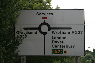
A short way down the road from the hospice I noticed the road sign above which was quite apt. After leaving the hospice I joined the Wealdway close to the new cyclopark which has recently opened in Gravesend. The Wealdway is a long distance path linking Gravesend with Eastbourne in Sussex.


I only stayed on the Wealdway for about a mile or so as far as Ifield Court where I joined another path leading through fields and farmland in the direction of Jeskyns Wood. The only company I had on this part of the walk was my friend shown above.


I walked through Cobham village passing the church. It was about 10 AM and everything was quiet. I joined a long road called Lodge Lane which runs uphill through Lodge Farm and then into the woods. 


At the top of the hill in a clearing in the woods is the Darnley Mausoleum which dates back to the 18th Century - more about that in a future post. I stopped at the Mausoleum for a quick break and to check my e-mails and tweets (I know - very sad!). I was pleased to see that donations were continuing to come in at a steady rate.

After a long walk through the woods I eventually hit the North Downs Way near Cuxton. 


From this point on my route will basically be following the North Downs Way (NDW) all the way through to Dover. The next major landmark or actually landmarks are the three bridges which cross the River Medway. There are two road bridges which carry the M2 motorway and a rail bridge for Eurostar and hi speed trains.


My great uncle was a civil engineer and he worked on construction of the first road bridge in the 1960's. 


I have driven over the bridges hundreds of times but it was the first time I'd walked across. Just before reaching the elevated section of the bridge I saw the sign below.


The bridge is certainly very high and it would make a mess of you if you fell/jumped off...


In the above picture you can (just about) see Rochester Castle and Cathedral in the distance (left of the picture). The walk across the bridge was noisy with the volume of traffic. Soon after the NDW crosses into Nashenden Down Nature Reserve and climbs uphill.

There are good views of the Medway Valley from the top of the ridge. At this point the sun had come out and it was quite warm so I stopped for another quick break before continuing on.


In the middle of the woods there is a pub called the Robin Hood. I decided to treat myself to a pint and a sandwich. They were both very nice and the bar staff were polite and friendly but at £ 8.20 I thought I'd bought shares in the place. What happened to robbing the rich to pay the poor? Perhaps the place should be renamed...


About a mile or so on from the Robin Hood is the viewing point at the top of Bluebell Hill, one of the highest hills in Kent at around 525'. At the viewing point is a memorial to the crew of the Kent Air Ambulance who died in a crash.


The Medway Valley has been inhabited for many thousands of years. About another mile from the viewing point at Bluebell Hill is Kits Coty the remains of a Neolithic burial chamber. After passing Kits Coty I headed into the woods above Boxley.

Another steep climb. At the same time the weather decided to misbehave and it started to chuck it down. Fortunately the tree cover was quite dense most of the time so I didn't get too wet at this point.


In the wood I came across a NDW marker showing "only" 46 miles to Dover. Also in the woods I noted some deep craters approximately 20-30' deep and very symmetrical. I suspect these may be bomb craters from World War II. Either poorly aimed German bombs which should have been destined for RAF Detling or jettisoned bombs. I have raised this on a local history forum and will report back if there are any further developments.

Finally after about four miles walking through the woods I reached my planned finishing point for the day - Detling.


The village was cut into two halves by the A249 trunk road in 1962 and no proper pedestrian crossing was put in place. Over the years several local people, mainly elderly, were killed trying to cross the road and get from one side of the village to the other.

On 16th December 2000 there was a double tragedy when an eight year old girl called Jade Hobbs and her grandmother were both knocked down and killed. The residents of Detling had been campaigning for twenty years to get a safe pedestrian crossing built.

Following the tragedy in 2000 the residents, together with the local council and others raised funds to build a footbridge which opened in 2002. The bridge was named in memory of Jade.


Just the other side of Jade's crossing is a memorial to the airmen and ground crew that served at RAF Detling between 1915 and 1945. The airbase closed in 1959 and what remains of the site is now used as an exhibition ground.

I reached Detling at 5 PM. Eight hours walking including a few pit stops. Nineteen miles. Three blisters so far.

On day two I will be walking from where I left off in Detling through to Ashford. 

There is still plenty of time to sponsor me and make all the blisters worthwhile.... Just go to my Virgin Money Giving page at the link below.

http://uk.virginmoneygiving.com/glenhumble

Many thanks for your continued support and remember to look out for the next update.

UPDATE - For Day 2 of My Big Walk please see here